
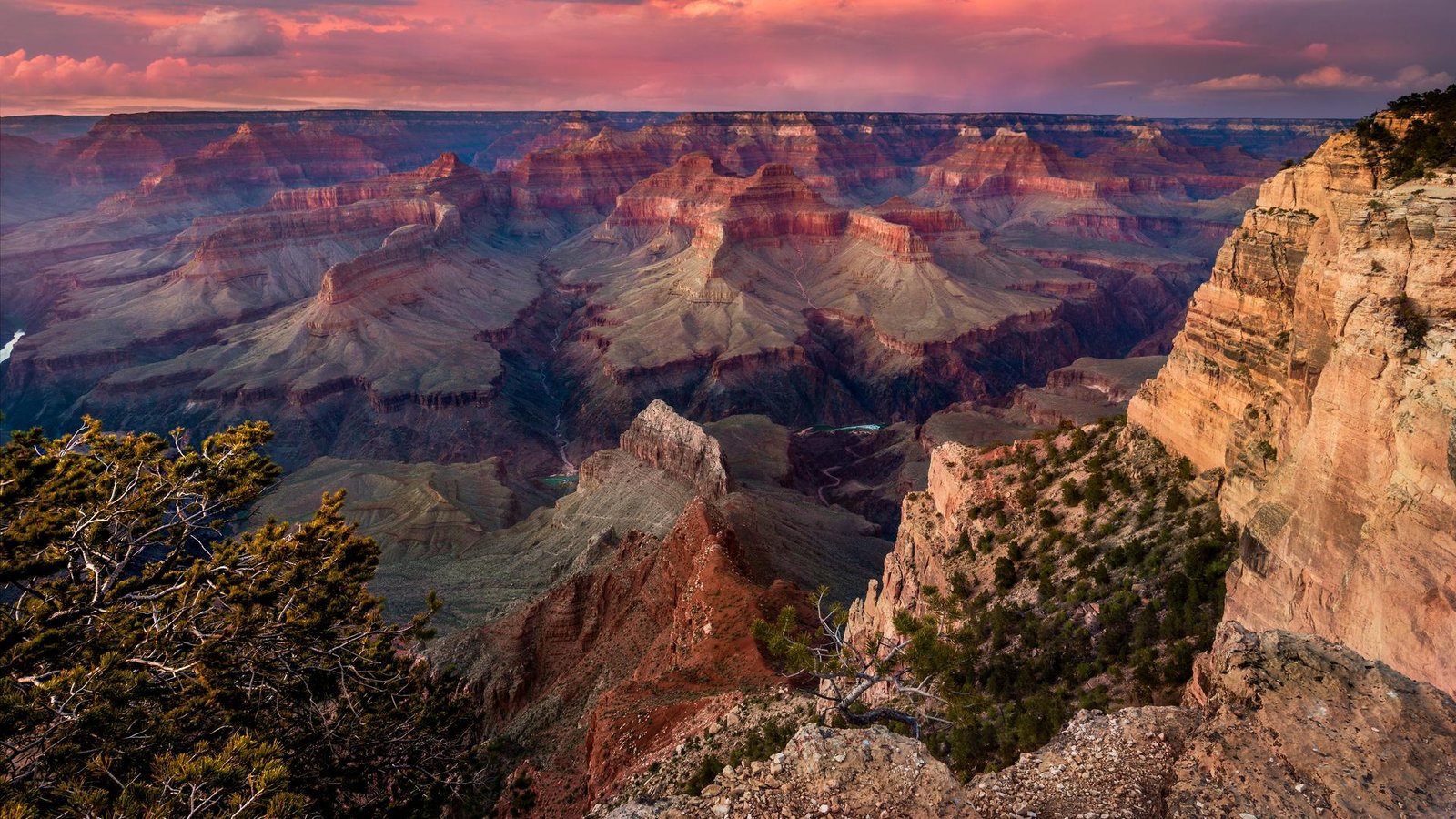
The breathtaking curves and steep edges were formed over millions of years. Water cut a mile deep through rock, twisting in a way that didn’t always make sense to scientists.
It’s long been understood the Colorado River carved out the Grand Canyon in northern Arizona, creating a geological masterpiece enjoyed by millions of visitors each year.
But the river alone does not explain the 10-mile-wide landmark. And this month, a team of scientists reported evidence they say backs a long-debated hypothesis about an ancient lake.
Scientific discussion about the Grand Canyon’s formation dates back to the 1800s. More than 150 years later, a study led by the United States Geological Survey “provides strong evidence” the Colorado River first filled a prehistoric lake bigger than Lake Michigan 6.6 million years ago, and that a spillover released a flood of water that spread throughout the canyon we see today, shaping not only the landmark, but the Colorado River’s path.
“By tracing the mineral grains in these lake deposits, we can see exactly when the Colorado River reached this basin,” USGS geologist Ryan Crow said. “The evidence points clearly to a Colorado River-fed lake that could have spilled westward, establishing the river’s course through what is now the Grand Canyon. It’s a simple but powerful explanation for how the Colorado River system took shape.”
Not without controversy
Ever since John Wesley Powell, a geologist and the USGS’s second director, first boated the Colorado River in 1869, scientists have contemplated how and why the water turned westward.
The spillover debate has been controversial, long debated by geologists in competing studies dating back decades.
The April paper published in Science details how the team analyzed sand deposits in the once-ancient Lake Bidahochi — now a basin — and found they matched those of the same age in the Colorado River watershed downstream.

Despite the new findings, not everyone is convinced. Science reported Rebecca Flowers, a geochronologist at the University of Colorado, told the publication the study “makes a compelling case that the Colorado filled the Bidahochi … but it doesn’t prove the spillover scenario.”
Colorado River legacy
Between 5 and 7 million years later, the Colorado River Basin is a dwindling lifeline for seven states. One week ago, Straight Arrow reported the Bureau of Reclamation ordered an emergency release of water from an Upper Basin reservoir to feed communities downstream in light of one of the worst snow seasons on record.
The plan is to release up to 1 million acre-feet of water from the Flaming Gorge Reservoir to stabilize Lake Powell, which risks dropping too low to deliver water and generate hydropower. If water levels get too low, it could damage the dam’s infrastructure.
Interior Secretary Doug Burgum praised the step as necessary given “unprecedented drought conditions,” but the move is also a temporary fix.
Upper Basin states voted in “reluctant favor” of releasing the water this week, the Colorado Sun reported.
Whatever caused the Colorado River to turn westward and eventually reach the Gulf of California all those years ago, the seven states that rely on the water are thirsty for a plan.
The current agreement divvying up water expires in 2026, and states aren’t signing on to the federal government’s plan for the future. Lower Basin states like Arizona call the rationing plan “unacceptable,” while Upper Basin states say it “fails to impose adequate shortages in the Lower Basin to protect the system.”
Round out your reading
- Work for food: New SNAP rules reshaping who gets to eat.
- How Iranians actually feel about regime change and war.
- Feds warn that Russians may hack your internet router. Why?
- The truth behind a medical condition that never existed.
- We’re building a new Straight Arrow. Help us shape our future by taking our survey.